Category:Maps of Prague Metro
Jump to navigation
Jump to search
Media in category "Maps of Prague Metro"
The following 64 files are in this category, out of 64 total.
-
 1998 - M-System - Web project.jpg 3,250 × 1,700; 3.21 MB
-
 20190203 PrahaTram 3270 (47401625182).jpg 7,952 × 5,304; 7.13 MB
-
 Bezkova Nuclear Bunker (16710865313).jpg 5,184 × 3,456; 5.64 MB
-
 Blank map metro Prague.svg 799 × 611; 21 KB
-
 Dejvicka.png 908 × 517; 42 KB
-
 Florenc Prague metro station on the site map.svg 908 × 517; 54 KB
-
 Florenc-mapa.svg 908 × 517; 50 KB
-
 Florenc.png 908 × 517; 43 KB
-
 Jizni konec linky D uppraha.jpg 686 × 521; 101 KB
-
 Karlovo náměstí, stanice metra, informační panely.jpg 3,156 × 2,331; 762 KB
-
 LineA prague metro completed.jpg 2,006 × 330; 184 KB
-
 LineE prague metro future.jpg 1,860 × 450; 239 KB
-
 Linka d schema.jpg 3,615 × 755; 449 KB
-
 Mapa-metra-Praha.gif 1,535 × 475; 46 KB
-
 Metro Map Prague in 2019.01.jpg 3,264 × 2,448; 1.52 MB
-
 Metro Map Prague in 2019.02.jpg 3,264 × 2,448; 1.56 MB
-
 Metro Map Prague in 2019.03.jpg 3,264 × 2,448; 1.52 MB
-
 Metro Map Prague in 2019.04.jpg 3,264 × 2,448; 1.69 MB
-
 Metro Map Prague in 2019.05.jpg 3,264 × 2,448; 1.58 MB
-
 Metro-D-mapa.jpg 996 × 842; 493 KB
-
 Mustek.png 908 × 517; 43 KB
-
 Můstek Prague metro station on the site map.svg 908 × 517; 53 KB
-
 Network door.JPG 1,280 × 960; 558 KB
-
 Network of lines.JPG 960 × 1,280; 543 KB
-
 PID mapa 2018 a3 kolejova doprava.pdf 2,481 × 1,754; 117 KB
-
 PID mapa 2018 a3 kolejova doprava.png 3,309 × 2,339; 1.05 MB
-
 PID mapa 2018 a4 metro.pdf 1,754 × 1,239; 72 KB
-
 PID mapa 2018 a4 metro.png 2,339 × 1,654; 336 KB
-
 PID mapa 2018 a4 tramvajovy provoz.pdf 1,754 × 1,239; 94 KB
-
 PID mapa 2018 a4 tramvajovy provoz.png 2,339 × 1,654; 554 KB
-
 PID mapa 2018 a5 cyklo doprava.pdf 1,239 × 872; 87 KB
-
 PID mapa 2018 a5 cyklo doprava.png 1,654 × 1,166; 312 KB
-
 PID mapa 2018 en a3 kolejova doprava.pdf 2,481 × 1,754; 117 KB
-
 PID mapa 2018 en a4 metro.pdf 1,754 × 1,239; 71 KB
-
 PID mapa 2018 en a4 tramvajovy provoz.pdf 1,754 × 1,239; 94 KB
-
 Platform map.JPG 1,120 × 776; 302 KB
-
 Prague integrated transport.png 9,730 × 6,517; 2.91 MB
-
 Prague metro extension.gif 1,991 × 1,127; 1.23 MB
-
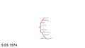
 Prague metro plan 1974.svg 1,150 × 900; 98 KB
-
 Prague metro plan 1978.svg 1,150 × 900; 166 KB
-
 Prague metro plan 1980 11.svg 1,150 × 900; 211 KB
-
 Prague metro plan 1980 12.svg 1,150 × 900; 237 KB
-
 Prague metro plan 1984.svg 1,150 × 900; 251 KB
-
 Prague metro plan 1985.svg 1,150 × 900; 323 KB
-
 Prague metro plan 1987.svg 1,150 × 900; 335 KB
-
 Prague metro plan 1988.svg 1,150 × 900; 361 KB
-
 Prague metro plan 1994.svg 1,150 × 900; 404 KB
-
 Prague metro plan 1998.svg 1,150 × 900; 444 KB
-
 Prague metro plan 1999.svg 1,150 × 900; 450 KB
-
 Prague metro plan 2001.svg 1,150 × 900; 459 KB
-
 Prague metro plan 2002 floods.svg 1,032 × 704; 230 KB
-
 Prague metro plan 2004.svg 1,150 × 900; 470 KB
-
 Prague metro plan 2006.svg 1,150 × 900; 482 KB
-
 Prague metro plan 2008.svg 1,150 × 900; 501 KB
-
 Prague metro plan 2012.svg 1,150 × 900; 501 KB
-
 Prague metro plan 2015 mk.svg 1,150 × 900; 421 KB
-
 Prague metro plan 2015.svg 1,150 × 900; 555 KB
-
 Prague metro plan 2022.png 1,150 × 900; 151 KB
-
 Prague metro plan 2022.svg 1,150 × 900; 54 KB
-
 Prague metro plan with Line E or Line O.jpg 1,164 × 726; 106 KB
-
 Prague, Czech Republic, April 2016 - 73.JPG 4,000 × 3,000; 2.02 MB
-
 Pražské metro, kolejové schéma (2015).pdf 5,025 × 3,566; 73 KB
-
Zprovoznovani metra animace.ogv 1 min 42 s, 960 × 720; 7.28 MB
-
 Создание Пражского метрополитена.gif 1,991 × 1,127; 1,022 KB

.jpg)


.jpg)